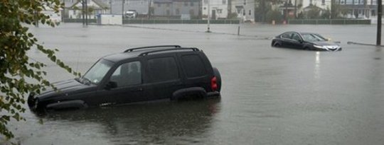
US scientists have warned Americans that they can expect more and perhaps fiercer hurricanes than usual from the Atlantic Ocean this year.
The Climate Prediction Center at the National Oceanic and Atmospheric Administration, NOAA, is forecasting ”an active or extremely active season” for hurricanes in 2013.
It says several climatic factors are expected to combine this year to cause the unusually high level of hurricane activity. One of these is the higher than usual sea temperatures.
For the six-month hurricane season, which begins on 1 June, NOAA’s Atlantic Hurricane Season Outlook says there is a 70% likelihood of 13 to 20 named storms, which have winds of 39 mph or higher.
Of these storms, NOAA says, 7 to 11 could become hurricanes, with winds of 74 mph or higher, including 3 to 6 major hurricanes, where wind speeds will reach 111 mph or more.
NOAA says: “These ranges are well above the seasonal average of 12 named storms, 6 hurricanes and 3 major hurricanes.”
Dr Kathryn Sullivan, NOAA’s acting administrator, said: “As we saw first-hand with [2012's Superstorm] Sandy, it’s important to remember that tropical storm and hurricane impacts are not limited to the coastline. Strong winds, torrential rain, flooding, and tornadoes often threaten inland areas far from where the storm first makes landfall.”
NOAA says three “climate factors that strongly control Atlantic hurricane activity” are expected to combine to produce an active or extremely active 2013 season.
One of these is the continuation of an atmospheric climate pattern, which includes a strong west African monsoon, that is responsible for the continuing era of high activity for Atlantic hurricanes dating from 1995.
The second factor which NOAA identifies is the warmer than average water temperatures being recorded in the tropical Atlantic Ocean and Caribbean Sea. This may have a significance beyond the hurricane forecast itself.
One suggested explanation for the slight slowdown in global warming over the last decade is that extra heat is going, not into the atmosphere, but into the oceans, and the warming to which NOAA refers appears to be consistent with this.
And to reinforce the atmospheric pattern and role of the oceans, NOAA says, El Niño (the periodic disruption of weather patterns in the Pacific) is not expected to develop and suppress the formation of hurricanes in 2013.
By contrast, NOAA is predicting that both the Eastern and the Central Pacific basins will have below-normal hurricane seasons this year.
NOAA’s seasonal hurricane outlook does not forecast where an individual hurricane is likely to make landfall, nor does it predict how many storms will hit land.
Among other improvements this year, NOAA plans in July to commission a new supercomputer which will run an upgraded Hurricane Weather Research and Forecasting (HWRF) model providing significantly better depictions of storm structure and improved storm intensity forecast guidance.
It will also transmit radar data in real time from its aircraft to help forecasters to produce better analyses of rapidly evolving storm conditions, a development which could improve the HWRF model forecasts by 10 to 15%.
NOAA will issue an updated outlook for the Atlantic hurricane season in early August, just before the historical peak of the season. – Climate News Network
Atlantic Hurricane Season Outlook: May 23, 2013
NOAA’s Climate Prediction Center (CPC) has issued its 2013 Atlantic hurricane seasonal outlook. In this video, Gerry Bell, a NOAA CPC meteorologist, explains that as of May 23, 2013, the outlook favors an above-normal Atlantic hurricane season from June 1 through November 30. During active hurricane seasons, the United States and the region around the Caribbean Sea typically have more landfalls than average. Bell also explains the climate factors behind the increase in hurricane activity observed since 1995.
{youtube}A_fA9K2dOM0{/youtube}


